Menu
All Attractions
Paju
- Imjingak Dorasan Station The 3rd Tunnel Inter-Korean Forest Cooperation Center Odusan Observatory Dongwha Gyeongmo Park The Catholic Church of Repentance and Atonement Gloster Hill Seolmari Battle Memorial Park Cemetery for North Korean Soldiers Libby bridge Club Last Chance Songchon bridge Geomdansa Temple National Folk Museum of Korea Paju Chang Chun-ha Memorial Park DMZ Observatory Paju Jangneung Dora Observatory
Key Attractions
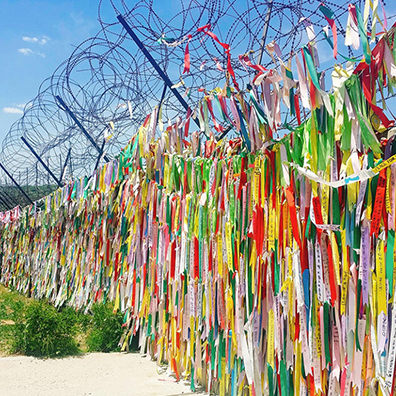
Imjingak
임진각Paju is the place where the desire for unification is gathered the most in Korea. Since Tongil-ro, the
endpoint of National Road No. 1 that started from Mokpo, and Jayu-ro, the road paved with a desire
for peace, meet at Imjingak. This place soothes the resentment and pain of 10 million displaced people.
Paju is a perfect place for the slogan of "the end point of division and the beginning of unification."
The building, which means "the pavilion of the Imjin River," was built in 1972 when inter-Korean
meeting started. It is a resting place to soothe the pain of displaced people as divided nation move on
the way to communicate.
Dorasan Station
도라산역One of the stations on the Gyeongui Line connecting Seoul and Sinuiju (international border between
north Korea and China) is named after Dorasan. The Gyeongui Line Restoration Project started in 2000,
the construction of Dorasan Station is completed in early February 2002 and restored the 4-kilometer
line connecting the station to Imjingang Station in the south.
Dorasan Mountain in history emerged as an icon of unification by the result of the "Dorasan
Declaration" with the President Kim Dae Jung. On a Lunar New Year morning in 2002, a train carrying
600 displaced people ran all the way to Dorasan Station. George W. Bush the one put the Korean
Peninsula into tension with his "axis of evil" remarks visited Korea in February 2002. Kim Dae Jung and
Bush visited Dorasan Station on Feb. 20, gave a speech, and held an event to sign "We hope that this
railroad will bring Korean families together" on a rail sleeper, making it an iconic venue for the
unification of the Korean Peninsula

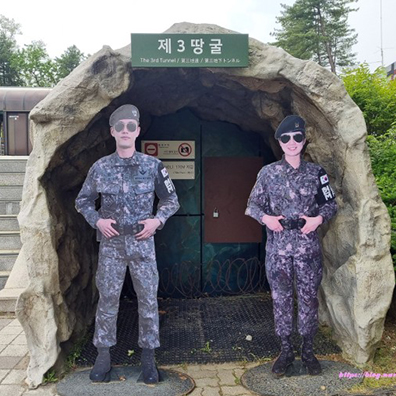
The 3rd Tunnel
제3땅굴The 3rd Tunnel which made for invading South Korea was discovered in October 1978. It gained
attention because its location is close to Seoul and extends to 400 m south of the DMZ.
Discovery Process - The Third Tunnel was drilled in the Munsan area since 1975 by Kim Bu-sung of
North Korea, who defected to the South on September 5, 1974, based on the underground excavation
work intelligence, but the tunnel was not captured. Later, in the early morning of June 10, 1978, an
investigative team at the site discovered a waterway with a heavy sound in one of the boreholes in the
tunnel. At the time, Chun Doo-hwan, the commander of the 1st Infantry Division, was briefed and
conducted a reverse tunnel excavation work in the surrounding area, and a third tunnel was discovered.
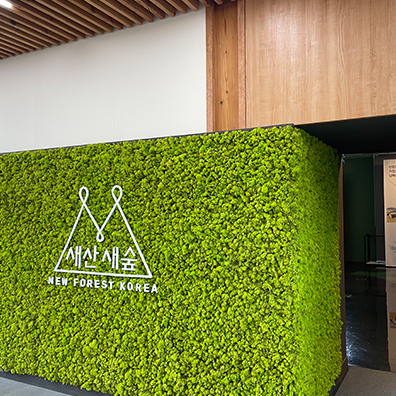
Inter-Korean Forest Cooperation Center
남북산림협력센터The Inter-Korean Forest Cooperation Center was established under the slogan "Connecting North and
South with the Forest" based on the need to maintain security through self-production of seedlings,
pre-purchase and storage of seedlings, and establish a base for inter-Korean exchanges in seedlings,
materials, technology, and manpower for afforestation.
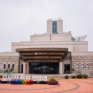
Odusan Observatory
오두산 전망대Odusan observatory was built in 1992 for the resentment of separated families and used as an
experience stamp for unification education.
Since its opening, about 19 million people have visited. Many have felt the reality of division, and it
establishes itself as the best national unification education center in Korea. It is a way of expressing the
expectation of unification and the pain and separation of division.
Dongwha Gyeongmo Park
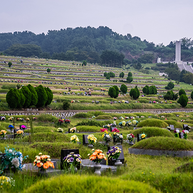
동화경모공원It is a cemetery and an enshrinement hall. It targets the displaced people in the north, and Paju
citizens can also be buried in some graves and enshrinement halls.
Roh Tae-woo, the 13th president who served as the president of the Republic of Korea was not
allowed to be buried in the national cemetery. He was not a citizen of Paju but was allowed to be
buried specifically due to his ties to Paju. The people defected from North Korea can have burial
qualifications in here.
The Catholic Church of Repentance and Atonement 참회와 속죄의 성당
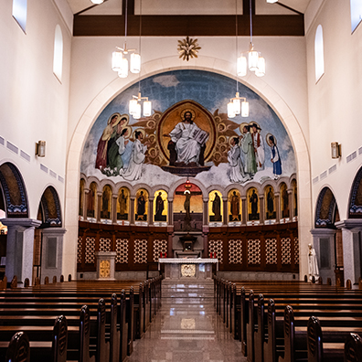
Cardinal Kim Soo-hwan hoped for a place to pray for peace between the two Koreas. Through his will,
North Korea defectors raised money to build a cathedral of penance and atonement. The purpose was
for the unification, harmony, peace, and orthodox succession. With the German reunification began
through exchange and support with the motif of the West German church that contributed. It is a
cathedral built to heal the wounds and pains of past wars and pray for true peace, not war, on the
Korean Peninsula where we live.
In order to reproduce the appearance of the North Korean church, for the event if it disappears, the
exterior of the cathedral was designed by calculating the size of the bricks at that time based on
photographic data about the North Korean church from Germany and the United States. The interior of
the cathedral is decorated based on the interior of the Benedictine Abbey Daeseongjeon, which was
located in Deokwon, North Hamgyong Province.
Gloster Hill Seolmari Battle Memorial Park
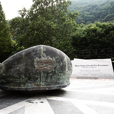
영국군 설마리 추모공원This monument was established in the memory of the British soldiers who died in Seolmari Battle
during the Korean War. Although the highland was completely surrounded by the enemies, the English
soldiers fought until their death. Nearby rocks were gathered to establish the structure, and 4
monuments total were constructed with 2 each on bottom and top position.
The top left monument is engraved with UN flag, and the top right monument is engraved with the
unit sign board of the sacrificed British soldiers. The bottom left monument is engraved with the
record of battle situation in Korean while the bottom right monument has the same contents in English.
This important cultural heritage vividly shows the participation of the United Nations forces in the
Korean War.
Cemetery for North Korean Soldiers
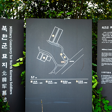
북한군 묘지Cemetery for North Korean Soldiers is a burial ground for North Korean casualties of the Korean War
and North Korean agents killed in South Korea since the end of the war.
This cemetery was built in the sense that the South Korean government complies with the Geneva
Conventions and protects the humanitarian spirit.
Libby bridge
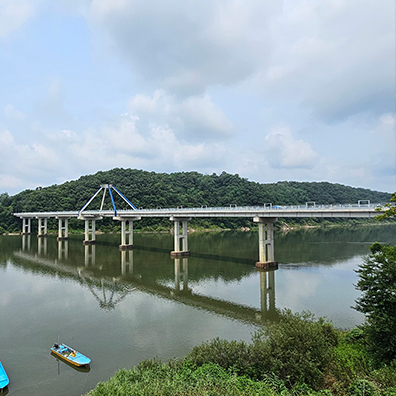
리비교Construction of Libby bridge was completed on July 4, 1953. This was eight months after October 1952
to transport troops and military supplies to the northern part of the Imjin River during the Korean War,
and it is the first concrete bridge constructed by the U.S. military.
Two casualties occurred during the construction of the bridge. Corporal Kim Ho-deok, a private first
class and James E. O'Grady who drowned while saving a Korean civilian worker who was in danger of
drowning due to a capsized boat.
The commanders of the Construction Engineers suggested the names of the two victims as bridge
names, but the command of the 8th U.S. Army named it, George D. Libby on July 20, 1950. This was
the 3rd Combat Engineer Battalion, and a Korean War District combat hero.
Club Last Chance
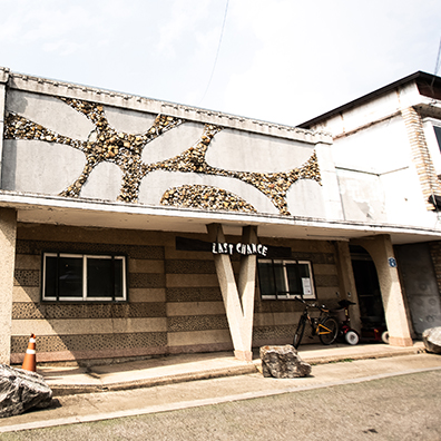
라스트 찬스With the presence of U.S. troops in Jangmaru, Paju in the 1960s, the number of entertainment
establishments such as clubs and theaters has increased, drinking and singing, making it a more
colorful street than Myeong-dong.
there is a building called "Last Chance," which means there are no more entertainment facilities, if you
pass this club, and it is known that Cho Yong-pil was active when he was unknown.
Songchon bridge
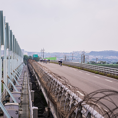
송촌교It belongs to the Han River, and it is a bridge where you can see Gongneungcheon Stream, the first
tributary of the Han River, and Imjin River, which originates from the Masikryeong Mountains in
Deokwon-gun, Hamgyeongnam-do(North Korea), flows into the Han River between Panmun-gun,
North Hwanghae Province, and Paju-si, Gyeonggi-do, and flows into the Yellow Sea.
Nearby, access is limited by barbed wire, so you can see relatively well-preserved wetlands and
migratory birds, and it is a part of Pyeonghwa Nuri Bicycle Trail course.

Geomdansa Temple
검단사It was founded by Hye-so (慧昭), a Buddhist monk from the 25th diocese of the Jogye Order of Korean
Buddhism.
It was founded in 847 (the 9th year of King Munseong of Silla). Hye-so had the nickname "黑" or
"Geomdan" (黔丹) because of his dark face, which originated from his nickname. One theory, however,
says that it was called "Geomdansa Temple" because Odusan Mountain, where the temple is located, is
on the black side.
National Folk Museum of Korea Paju
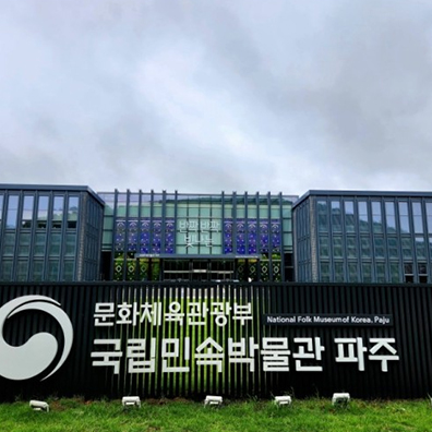
국립민속박물관 파주NNational Folk Museum of Korea Paju is an open storage for utilization of folk relics and archive
materials. An open storage is a type of friendly museum that combines exhibition techniques and allow
visitors to see relics from the close distance.
Chang Chun-ha Memorial Park
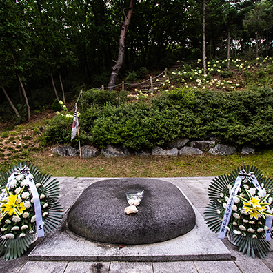
장준하 공원Chang Chun-ha was a Korean independence and democracy activist who later became a journalist in
South Korea. You can get a glimpse of Jang Jun-ha's love for his country by looking at the life of Jang
Jun-ha, who devoted his life to freedom and peace and democratization.
He was imprisoned several times because He was active in the democratization movement. He died in
a mysterious hiking accident in 1975 while leading the movement against the Yushin regime.
DMZ Observatory
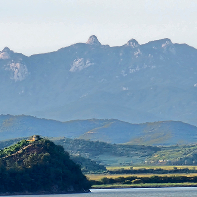
DMZ 전망대Located near to the Pyeonghwa Nuri Bicycle Road. You can see North Korea head-on from a close
distance, and farmland can be seen at glance within the Civilian Control Line.
Paju Jangneung
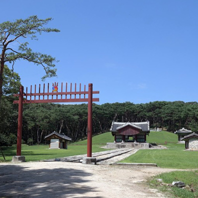
파주 장릉This is the tomb where King Injo, the sixteenth king of Joseon, and his wife Queen Inyeol are buried.
King Injo, who came to the throne in 1623, did not enjoy a peaceful time during his reign as series of
Manchu invasions in 1627 and 1636 swept the country. To improve the impoverished life of his people,
he launched a special tax policy called Daedongbeop (Uniform Land Tax Law) in 1623. Jangneung was
located in Paju during King Injo’s reign but moved to the current spot as on the stone sculptures
around the tomb were inhabited by snakes and scorpions. The graves of king and the queen are
placed together in the tomb. Instead of the traditional decorations like the twelve zodiac animal deities,
the stone screen is engraved with patterns of lotus flowers and peonies. These patterns, also visible on
the stone lantern, are characteristic of the seventeenth century
Dora Observatory
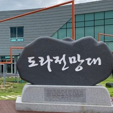
도라 전망대The Dora Observatory is located at the northernmost point on the western front where the Korean
Demilitarized Zone is passing by. The Dora Observatory offers a panoramic view of the Kaesong
Industrial Complex, Songaksan Mountain in North Korea. Third Tunnel and Dorasan Station are near
here. The places where you can view with the telescope from the Dora Observatory are military secrets
and photo lines are installed to prevent taking photos. The GOP line is also located right in front of the
Dora Observatory. As Dora Observatory is located within the civilian access control zone, it can only be
used for security tourism. Here was a place where a beacon was installed during the Joseon Dynasty to
notify the national crisis. It also used to be a gateway to connect the two Koreas and serve as a
communication center.
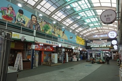
Munsan Free Traditional Market
문산 자유시장Starting in the Joseon Dynasty, Munsan Free Market, which became a collection of goods by supplying cargo not only to Hanyang (Seoul) but also to Pocheon, Kaesong, and Cheorwon through the Imjin River, came through Japanese colonial era and the Korean War together. It maintains the appearance of a traditional market in rural areas that cannot be seen in large cities such as Seoul. A variety of fresh products are available at low prices and there are many foods to eat.
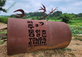
Unification village(Tongil Chon)
통일촌Unification village(Tongilchon), a village established in 1973, serves as a symbol of hope for peace and reunification on the Korean Peninsula. Modeled after the Israeli kibbutz, this self-sufficient community has transformed barren land into a thriving agricultural hub. Located north of the DMZ, Tongilchon offers visitors a chance to experience high-quality agricultural products such as Jangdan beans, tofu and learn about the history and culture of the Korean people.
031-953-5373
Business Hour(Korean Time): 09:00~18:00, Lunch 12:00~13:00
Close at weekend and holiday
Tour Course Guide

